Home
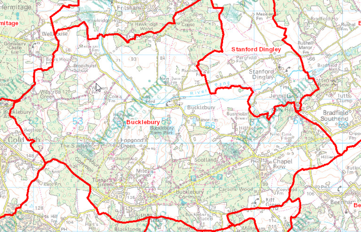
Bucklebury is a small rural parish in West Berkshire, situated between the A4 and the M4 and between Newbury and Reading.
The first recorded use of the name Borgedrberie is in a charter from the Anglo Saxon King Edwig granting wood for the rebuilding of Abingdon Abbey in 956 AD. The name Bucklebury is recorded in the Domesday Book (1086) and is written as Borgeldeberie, (sometimes Bucklilleberie or Burglebury) which means "Burghild's fortified place or borough". "Burghild" is believed to be an ancient Britton queen but this has always been a matter of debate.
Bucklebury is famous for its fabulous avenue of veteran oaks and the large common (900 acres) which links all the surrounding communities. The Common is undispersed with a number of greens which form an important part and character of the common, these include Westrop Green, Hopgood’s Green, Turner’s Green, Byles’ Green, Miles Green, Kiff Green and Chapel Row Green.
The Common is still presided over by the Lord of the Manor, the manor house being located in the village. The picturesque parish church of St. Marys is of Norman construction but was gradually expanded until the 15th century and there has been a long association with Reading Abbey.
The parish contains a number of communities:
- Upper Bucklebury - a village containing a general store, the Cottage Inn public house, a primary school, All Saint's Church and the Memorial Hall. It has the highest population of the communities. Turners Green, Byles Green and Mile's Green, which were originally isolated communities on Bucklebury Common, are now on the edge of Upper Bucklebury.
- Chapel Row - a small village containing the Blade Bone public house, the BlackbirdCafe and L Interiors. Each of these overlooks the ancient Chapel Row Green where fairs have been held for hundreds of years. Chapel Row grew in the late 1950's when housing was developed for those families who had been living in Nissen huts on the Common after they were abandonded by the Army following WWII.
- Bucklebury - the old village on the banks of the River Pang with the church of St. Mary the Virgin and a village hall, the extended and refurbished Victory Room. Once the home of a very active foundry, today it is a peaceful village. The River Pang, a chalk stream, runs through the parish and through the village of Bucklebury.
- Marlston - the Elizabethan style mansion, Marlston House dominates the small rural community of Marlston and was built for George Palmer (one of the founders of Huntley & Palmer biscuits) in about 1895 and since the end of the war has been the home of Brockhurst and Marlston Schools. The small parish church of St Mary adjoins the school with a commanding view over the Pang Valley.
- The Slade - a small linear hamlet set on a north facing hill sloping towards the river Pang. Like many of the small communities in the parish it was established on higher ground to prevent flooding. Until the 1900’s this small enclave in the Common, which is surrounded by ancient woodland, had the highest population in the parish and was very productive with the “Square” having a bakery, wheelwright, clockmaker, a tinker and a carpenter.
- Westrop Green - is small community nestles in the Woodland next to Eling Estate and is an integral part of Bucklebury Common to the West. This quiet tranquil setting is as a result of the only vehicle access being through Bucklebury Alley which is a no through road.
- Hillfoot - as the name suggests, is a small row of houses at the bottom of Chapel Row Hill. The council houses were constructed just after the second world war but the setting has a rural nature and the Farm by the same name, is the principal feature.
