The History of Ospringe
The idyllic Ospringe landscape was formed by the carving of two distinct valleys in the latter stages of the Ice Age and is today a thriving rural community in an Area of Outstanding Natural Beauty near the market town of Faversham in east Kent. The nine small settlements which now form the parish are believed to have evolved on roads carved through the countryside by Anglo-Saxon farmers, as they drove their animals southwards for the summer grazing and returned in the winter months for shelter. Many of the properties within the boundaries date from the 16th Century, and several are now Grade II listed structures.
Ospringe – recorded in ancient records as Ospringes – is believed to take its name from a fresh spring which rose close to where the Church of St Peter & St Paul now stands. The accepted derivation is from the Anglo-Saxon “os” and “spring”, meaning “spring of the divinity”. The parish is mentioned in the 1080 Domesday survey as having a church, a mill, a fishery, a salt-pit, 13 acres of meadow and “wood sufficient for the pannage of twenty hogs”. It was owned by the Bishop of Baieux until shortly after the survey, when according to historic records he fell “under the king’s displeasure” and it was confiscated by the king and repeatedly gifted to and taken back from others who fell in and out of favour. Royal visitors include King John, who is recorded as staying twice at a manor house in the parish for a month each time in the early 13th century. Other manors and estates, including Painters, Hansletts, Plumford and Whitehill also now make up the parish, together with the ancient seat of Brokedale, which later became known as Brogdale, and Elvyland – later to become Elverland.
The modern parish is roughly rectangular and extends from its northern boundary with the market town of Faversham marked by the A2 main road, to Eastling and Throwley in the South, and from Sheldwich to the East to Stone and Norton to the West at Newnham Road. Ironically, most the village of Ospringe itself does not fall within the boundary of the parish, having been annexed to Faversham in 1935 border changes. Instead, the parish has at its centre the village of Painter’s Forstal. The number of residents has quadrupled since the middle of the last century. In the 2001 census, there were 715 parishioners of all ages in 270 different households.

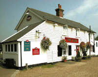
Painter’s Forstal takes its name from Painters, a 16th Century house on the edge of the village. There is one historic pub – The Alma – which remains a crucial hub for community life. The white clapperboard building has been a tavern since 1837 and was originally known as The Candle House, a name derived from the landlord lighting candles to guide thirsty hop pickers to the pub in the dark after working in the nearby fields. The bar, restaurant and garden now welcome locals, cyclist and walkers keen to explore the parish’s network of footpaths, bridleways and country lanes. The pub hosts monthly quizzes, events and a cribbage team that competes in a local league, and also offers welcome respite from the cold to the local carol singers who gather each Christmas to go house-to-house in the village bringing festive cheer.
Opposite the pub is a children’s playground, maintained by the parish council along with the small grass triangle – known as the ‘forstal’ – which is next to it and gives the village its name. Close by is the small Methodist church, Champion Hall, which doubles as a community venue for local clubs, events including parties and the annual Easter Egg Hunt for children. Many ramblers and families visiting the parish stay at Painters Farm camping site, which is just a few hundred metres’ walk away from the pub down a country lane. It is also the venue for the annual barn dances that brings together locals from surrounding villages and nearby Faversham.
Many, no doubt, are attracted not only by the rolling landscape of farmland, orchards and vineyards but by the parish’s most famous attraction – Brogdale Farm, which is home to the National Fruit Collection. There are guided and self-guided tours of the collection, which is owned and supported by the Department for the Environment, Food and Rural Affairs as an internationally recognised genetic resource and maintained in partnership with the University of Reading. The farm holds seasonal fruit festivals that bring in visitors from around the globe attracted by the chance to enjoy local produce and crafts. Annual events include the cherry and plum festivals in summer and the apple festival in autumn. It also holds courses in skills ranging from vegetable growing and pruning to preserving fruit and has the only nine inch gauge miniature railway open to the public in the UK. The nine locomotives run on a quarter of a mile of track through the orchards and are maintained by the Faversham Miniature Railway Society. There is also a market place courtyard with traders selling local meat, fruit, veg, meat and plants.
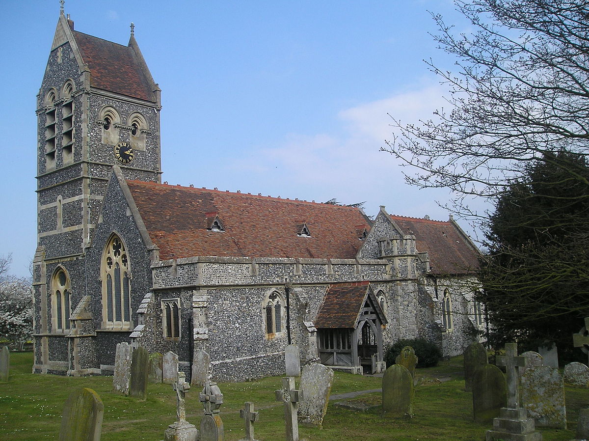
The parish church of St Peter & St Paul, which dates from 1086, stands at the edge of Ospringe village and just within the parish boundary. Its position was chosen specifically because it was close to the spring that used to rise on the opposite side of the road (now known as Water Lane) and that gave the parish of Ospringe its name. It is believed that there was probably a wooden church on the same spot in Saxon times. The church that stands there today has a Norman doorway in the north chancel wall and 13th century arches, while the giant font is also Norman. The tower was added in 1866 to replace a rare round one which collapsed in 1695 while being rung as a local tribute to William III, who was passing through the village at the time, while its organ was built in 1870 and is still used for most services. 18th century records describe stained windows, sadly no longer existing, that depicted “the figure of a mitred bishop, on the rack, with a knife on the table by him, and of another person ties to a tree, and wounded with arrows”. While the church is well-used for family events, the churchyard it a popular place for a quiet walk or rest. The building itself is also a resting place for other welcome guests – as a registered bat roost.

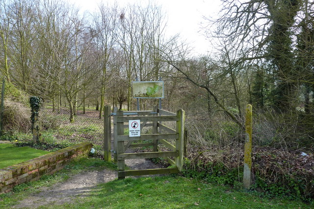
Wildlife is never far away in the parish, and a gate marked by wooden carvings on the edge of Painter’s Forstal leads the way into Lorenden Park. This hidden beauty spot offering stunning woodland walks in all seasons – and particularly during autumn – is a conservation area maintained by a private charitable trust. It can also be reached by an entrance at Whitehill – another hamlet within the parish which lies at the bottom of the valley and consists mainly of attractive listed buildings, the most prominent of which is Whitehill House. The walled Grade II-listed building clad in mathematical tiles which are a local speciality is now a farmhouse but in the late 18th century was home to Isaac Rutton, notorious as a smuggler. Lorenden Park once belonged to a manor house bearing the same name, which later became a convent and is now home to the parish’s only school. Lorenden is an independent preparatory and pre-prep school for around 100 children aged from three to 11. The residential areas are surrounded mainly by orchards, soft fruit farming, grazing for horses and sheep, and arable farmland.
Historical records dating back to the 18th century suggest that Judd’s Hill, to the north of the parish, was the site of a Roman military base and fort called Durolevum. It was first located in 1782 when a 1st century brooch was found during ploughing, and a nearby Roman settlement was confirmed during the cutting of a gas pipe trench in 1931. Edward Hasted records in 1798: “The Romans undoubtedly had some strong military post on this hill, on the summit of which there are the remains of a very deep and broad ditch, the south and east sides are still entire, as is a small part of the north side at the eastern corners of it, the remaining part of the north side was filled up not many years since.” He also records how the digging of a road nearby unearthed “quantities of fragments of Roman culinary ware, and a coin of Vespasian”. Continued ploughing has since removed almost all evidence of the four-and-a-half acre settlement, which lies within the grounds of Syndale Park. However, the settlements that emerged through Saxon and Roman times have developed into a vibrant rural community of varied private and social housing, and new legions now march through Ospringe – drawn by the spectacular scenery, listed buildings and place in history.