East Worldham
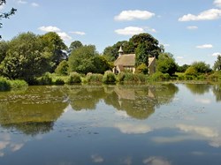
East Worldham is the main settlement in Worldham Parish, a civil parish with a population of approximately 310, within the East Hampshire District. It is situated about two miles south east of Alton on B3004. There are large areas of farmland and woods around it with spectacular views. Approximately two thirds of the population of the parish, about 200 people live in East Worldham or in houses close to the village. The boundary of the South Downs National Park includes much of the village.
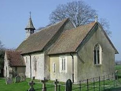
The busy B3004 runs through the village and a series of narrow sunken lanes with interesting names connect to it – Blanket Street connecting East and West Worldham, Wyck Lane and Shelleys Lane. East Worldham has ten listed buildings including its medieval church, several cottages, some of which are thatched and old farmhouses. Walkers are attracted to East Worldham by the Hangars Way and other footpaths that provide fine views to Alton, the Surrey hills and the Sussex Downs.
Many households live in houses built before 1900. During the 20th century there was a gradual increase in the number of houses in East Worldham. In recent years there have been some small housing developments, both private and housing association. Redundant farm buildings have been converted both to housing and for industrial purposes. East Worldham has a settlement policy boundary.
The population of East Worldham fluctuates both in terms of numbers and of age groups. There are many retired people, young families, people who commute to London and to neighbouring towns for work and people who are self employed. There is no longer a school in East Worldham so children attend a number of the schools in the area. Farming used to be the dominant occupation in East Worldham. Now East Worldham has a golf course and a site for the annual convention (Jalsa) of the Ahmadiyya Muslims.
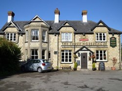
East Worldham is a small but close-knit community. There is an annual fete, activities such as dog show, parish walks, whist drives, jumble sales, garden openings and harvest suppers and village organisations such as the Worldham Choir the History Group and the Women’s Institute. East Worldham has no shop but there is a limited bus service and the Three Horseshoes pub as well as the village hall.
Brief History of East Worldham
An Iron Age Hillfort [c800 BC, Scheduled Ancient Monument], encircled the summit of King Johns Hill, which stands to the east of the village of East / Greater Worldham. The Roman road from Chichester to Silchester ran through Binswood, crossing Green Street and Pookles Lane and on towards Neatham. Roman building materials have been unearthed in the churchyard and this area is designated as ‘of high archaeological potential’.
At the time of Domesday, ‘Worldham’ (which seems to have included both East and West Worldham) was held by Geoffrey de Venuz the Marshal by the service of bearing the marshal’s rod in the king’s household throughout the year. Geoffrey’s descendants held the manor for about 250 years and established a private deer park for themselves. The much-debated effigy in St Mary’s, Church is likely to that of a lady of the de Venuz family.
Part of East Worldham lay in Woolmer Forest. The Royal Forests were areas which were not necessarily covered with trees but places where hunting took place and which were under Forest Law. The remains of a medieval hunting lodge have been excavated on King Johns Hill. The name is somewhat misleading: local tradition has the belief that ‘the King had a house built on this hill for his use during the hunting season’. All the documentary evidence suggests that a lodge and associated buildings were erected in Worldham in the 1370s by order of Edward III and the hill’s alternative name of Lodge Hill implies that they were probably sited here. The private park had come into the King’s hands a few years earlier and it was then enlarged, taking in some of Woolmer Forest and Binswood. The latter is now an SSI and owned by the Woodland Trust.
Extracts from the East Worldham Church Wardens’ Accounts and other records give interesting insights into village life as it was centred on the old holdings of Shelleys, Freres, Sandals and Gurdons ( these were all combined into Old House Farm over the years), and also Heathers, Clays, Porters, Park, Smiths and Manor Farmsit , names and buildings that continue in the village.
There are ten grade 2 listed buildings and at least as many other sites with long histories in the village. The oldest house may be Old House Farm. Although listed as a 17th century building it is probably much older. In 1472 the property, then known as Gordons, it was purchased by Winchester College. Sir Adam de Gurdon, of whom stories are still told, held land in Worldham in the 13th century. Until just over 100 years ago some of the fields were still in medieval strip form.
Sandals, now listed as a row of three 17th century cottages, was the site of one of the holdings combined with Gurdons and there are documents going back to 1255 including one in 1329 which was witnessed by John de Sandale.
Heather Cottage is a picturesque thatched 17th century cottage perhaps named after William Heather who was assessed as a householder with 3 hearths in the 1665 Hearth Tax returns. In 1877 James Christmas sold a very small plot beside the cottage for a Wesleyan Methodist Chapel. This was demolished in 1937,and its plot is now the driveway to the cottage.
The Victorian era was a time of great change in East Worldham. In 1862 Dr Fell arrived as the new Vicar and immediately began work on the dilapidated 12th century parish church. The chancel was refurbished and the original apse replaced while plans were drawn up for the extensive renovation of the roof and nave. A new village school was built on land donated by Lord Sherborne in time for services to be held there during the church’s restoration.
In the same period hop kilns were built on most farms and many farm buildings and cottages were replaced or repaired including new farmhouses at Clays and Porters Farms – the latter being merged with Park Farm. A major improvement was considered for Worldham Hill (now part of the B 3004), a notoriously steep climb up the Hanger. In 1892 Mr Hall, at his own expense, had plans prepared for ‘lowering’ the gradients of the hill by smoothing out four sections. The gate near Tylings Cottages which separated the common land of Green Street from the road up the hill was probably removed soon after this.
An Institute and Reading Room for the village men was built at the top of the hill by Mr J Baigent which became the Village Hall and is still in use. The first Parish Council Meeting met in 1894 in the schoolroom.
Henry Newman, the blacksmith, lived on the corner of the cross-roads where he built a large house. In the 1851 census, Henry described himself as a blacksmith although his wife’s niece, Matilda Harris, was there on census night and said to be a ‘bar maid’ – which may suggest that beer was already being sold in Henry’s home. By 1855 he opened a public house called the ‘Three Horseshoes’ and described himself as a blacksmith and shopkeeper. The bar was in a room of the house beside the present B 3004. The entrance has now been changed and the old walled garden is the front car park.
The 1842 Tithe Map shows the land usage for pasture and arable land to be surprisingly similar to the use today. However, at that time 32 acres of hops were grown. ‘Hops were king’ of the farming year, as the local saying went, and this very valuable crop increased and continued to be grown until 1996. During the hop-picking weeks travellers and hundreds of pickers came from Southampton, Portsmouth, and London, lived in huts and tented camps on the farms and enlivened the village! The season ended with a Horse Fair on the road outside the pub.
Truncheaunts
The old farm of Truncheaunts lies just within East Worldham parish close to the border with Alton.
Brief History
Truncheaunts was part of Alton until the boundary changes in the 1930s. The history of the site of Truncheaunts Farm can be traced back to mid-1200s when Elias de Roffa, also known as Elias le Marischal (the Marshal), seems to have acquired this and other property in Alton, in the 1250s and 1260s. It later came into the hands of William Trenchant who was said to be ‘an alien of parts of Normandy’. In the late 1500s, Truncheaunts was sold to the Knight family of Chawton although the property was leased out to tenants. The Knights eventually sold Truncheaunts in 1921.


